
El Paso Address Records by Era
Past occupants leave different kinds of dated traces in El Paso. El Paso County’s Historic Deed Index Books form the long property-record window, while the current official-records index follows another online path. El Paso directories add name-and-address snapshots, and Sanborn maps show the built setting rather than ownership. El Paso Border Heritage, the Historical Society, UTEP, and state archival guidance provide the library and repository alternatives when an online search stops. Start with the source that matches the time period, then record the source date, address layer, stable identifier, and what the result does not prove.
| Source | Documented span | Where held | What it can show |
|---|---|---|---|
| Historic Deed Index Books | 1874-1963 indexed historic range | County Clerk and Kofile portal | Grantor or grantee index references and book or page trail; images may require an account or payment. |
| Current Official Public Records | Current online index; earliest portal year not published in inspected sources | County Clerk portal and counter | Document number, deed name, subdivision, legal description, book or page, and file date. |
| El Paso city directories | Historical Society reports 1886-2011; selected editions digitized | EPCHS, Border Heritage, UTEP, and Portal to Texas History | Dated name, address, household, business, alphabetical, and street-section context. |
| Federal census | Public release follows the 72-year rule | Library genealogy resources and official census routes | Household, age, relationship, birthplace, and address-area context. |
| City permits | Public search route; full online start year not confirmed | City Planning and Citizen Access, then a records request | Project address, permit type, applicant or contractor, and status when the portal exposes it. |
| Sanborn maps | 1883, 1885, 1888, 1893, 1898, and 1927 objects found | Library of Congress, library, and EPCHS | Building, street, material, and neighborhood context at the map date. |
| Obituary or probate material | Coverage varies; complete index years not published | Border Heritage, EPCHS, and County Probate-Civil | Death, relatives, cemetery, executor, heir, and property leads that need separate confirmation. |
The table is a sequence, not a shortcut to an occupancy list. It keeps a deed, directory listing, map, and obituary in their proper roles while a past-address timeline is built.
El Paso Parcel Records at EPCAD
The most practical first record is the current parcel card at the El Paso Central Appraisal District property search. Search the exact address, and use its Advanced Search controls if the result is ambiguous. Save the Prop ID and GeoID before changing a tax year. On the detail card, keep the labels separate: Location Address, Mailing Address, Name, Owner ID, Legal Description, Property Use, Map ID, Neighborhood, exemptions, and values. A mailing address can be an agent or office, so it must not replace the situs or location address.
Then use the City GIS viewer or its EPParcels and Deeds services to compare the legal description, MAP_ID, PROP_ID, OWNER_ID, year built, situs ZIP, street components, and jurisdiction fields. GIS geometry locates and cross-checks a parcel. It is not certified title. EPCAD also does not supply deed images, so an address match here is the handoff to the County Clerk rather than the end of the research.
- Situs or location address
- The physical property location used in the assessment record. EPCAD says it does not create or verify situs addresses.
- Mailing address
- The place used for correspondence with the listed owner or entity. It may not be the property location.
- Legal description
- The lot, block, unit, tract, subdivision, or related land description used to match older recorded material when street wording changes.
- Prop ID and GeoID
- Parcel identifiers worth preserving before moving between tax years, maps, and recorded-instrument searches.
Note: Values, exemptions, owner names, and mailing details can change separately, so save the tax year and access date beside each field.
Tracing El Paso Recorded Transfers
An El Paso chain of title follows recorded transfers, not every person who stayed at an address. Begin with the parcel’s legal description and current owner name, then search the El Paso County Clerk’s current index for the purchase or transfer document. The current Official Public Records interface accepts document number, deed name, subdivision, style, book, page, lot, block, unit, tract, and file-date fields. Its results are limited to ten documents per search, so break a broad name or date range into smaller searches and keep a log of each query.
- Copy the current parcel’s Prop ID, GeoID, legal description, situs, and tax year from EPCAD.
- Search the current official-records index by the owner or deed name, legal description, subdivision, lot, block, unit, tract, and a narrow date range.
- Identify the transfer instrument and record its grantor, grantee, recording date, document number, and book or page reference.
- Search the seller as an earlier grantee or owner, testing initials, entity suffixes, and documented name variants.
- Repeat backward, preserving the source path. At the historic boundary, move to the Historic Deed Index Books rather than assuming the current portal covers the earlier record.
- Grantor
- The party transferring an interest in a recorded instrument.
- Grantee
- The party receiving the interest shown in that instrument.
- Chain of title
- A sequence of recorded transfers tied to the same property, usually tested with legal-description and document references.
- Recorded instrument
- A deed or related filed document. An index hit provides a trail, not a determination of present title or presence.
El Paso Historic Records in Kofile
The El Paso County Clerk identifies its Historic Deed Index Books as covering the 1874-1963 historic range. Kofile’s visible search structure includes Type, Year, Parties, Last Name, First Name, and a document route using Book, Volume, and Page. The available menu can show broader series or date options, but the County’s stated historic deed range is the reliable label for this purpose. Party fields can depend on an earlier type or year choice, so record every selected value before a search is rerun.
Kofile’s El Paso Historic Deed Index portal displays the index-book and document-search routes for the County Clerk collection.
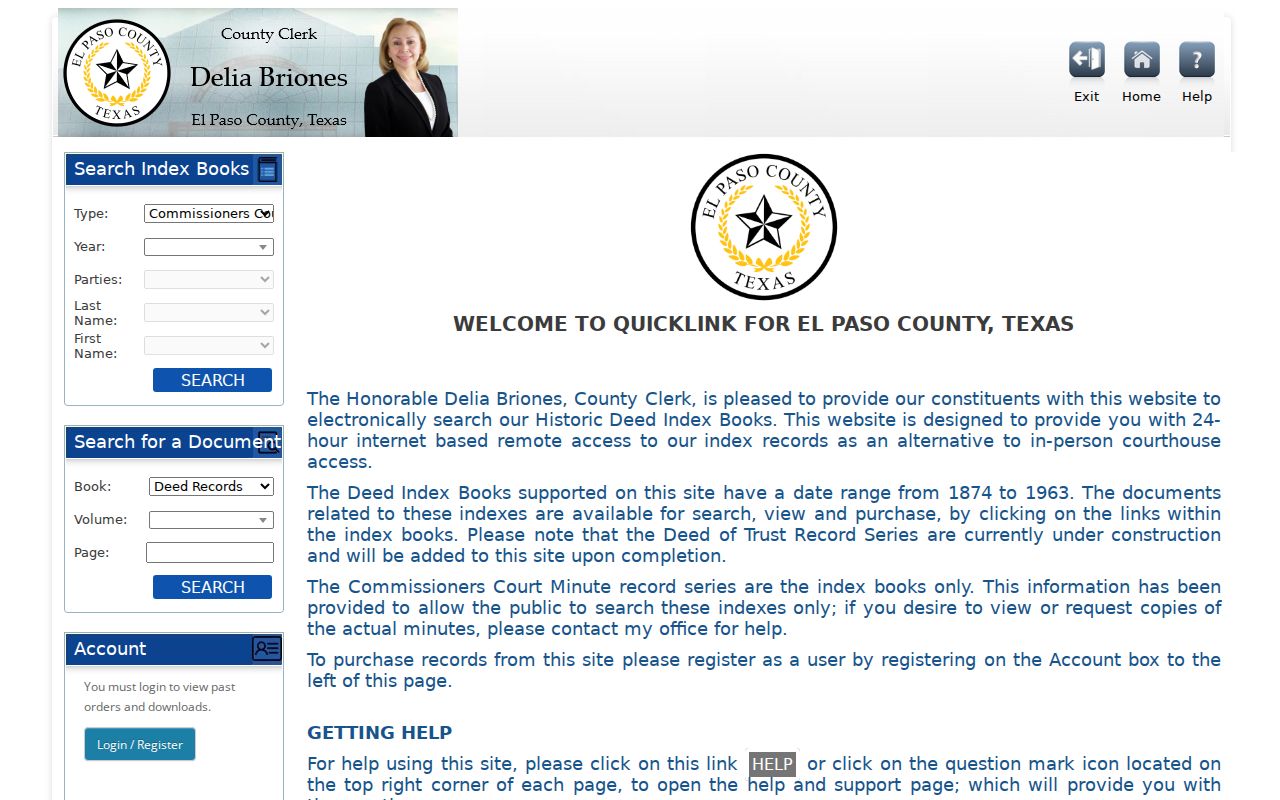
The portal says records may be searched, viewed, and purchased, with an account required for purchase. It also marks the Deed of Trust series as under construction. That gap matters when a researcher expects a mortgage or deed-of-trust trail. A historic index reference should lead to the underlying document or Clerk copy process, not to a conclusion about who lived there.
El Paso Household Records in Directories
Recorded transfers and past households are different trails. The El Paso County Historical Society reports city-directory holdings from 1886 through 2011, although neither an exhaustive annual inventory nor a separately identified reverse or criss-cross run was found in the inspected sources. The digitized 1889 and 1912 volumes both have street sections. Use an alphabetical listing for name variants, then search the street section for the number and adjacent numbers in the same edition. This is a dated publisher association, not proof that every household member was present or that a listed person owned the parcel.
The historical collections themselves are detailed on the El Paso City Directory page. For this address trail, capture the directory year, page, section, printed name, number, street spelling, and any marker only after reading the volume’s abbreviation key. Do not call a street section a dedicated reverse directory unless a catalog record establishes that separate run.
- Choose a directory year near the transfer or address date being studied.
- Search the alphabetical pages for spelling variants, initials, compound surnames, and Spanish or English forms.
- Check the street section for the same number and nearby numbers, saving the printed page and section.
- Pair that snapshot with a public census release from the appropriate period and preserve its geography.
- Use newspaper, obituary, cemetery, deed, or probate material as independent corroboration, not as a substitute for the directory page.
El Paso Border Heritage staff can help locate city directories, microfilm, cemetery sources, vertical files, and newspaper dates. If an online volume fails to answer the question, the El Paso library, Historical Society, UTEP finding aids, and Texas archival guidance are the documented alternatives.
El Paso Census Records
Census material adds the household layer to a dated El Paso address trail, but its public release follows a 72-year rule. El Paso local research pages did not establish the latest public census year in their inspected material, so confirm the release status and the library database’s access terms before relying on a result. El Paso library genealogy resources can supplement official census routes with newspapers, vital indexes, cemetery records, and reference works. The census geography, enumeration date, and address-area context must remain with each note.
Use a census entry to test a directory snapshot, not to erase a conflict. A name can be printed differently, a street can be described by an older form, and a boundary can change. For El Paso, preserve Spanish and English place labels, compound surnames, maternal surnames, accents, initials, Juárez references, military names, and county-community labels as the source printed them. A changed result may be a different person or place rather than a simple indexing error.
Note: A historical address can map to a current parcel, multiple parcels, a right-of-way, or a changed footprint, so record the address form used by each source.
El Paso Map Records
Sanborn maps are the most useful El Paso map layer for testing whether an old address, alley, footprint, or nearby use is plausible at a particular date. El Paso objects were found for 1883, 1885, 1888, 1893, 1898, and 1927, and the 1927 Library of Congress volume has 23 sheets. The maps can show building footprints, construction materials, uses, street numbers, fire-protection features, and nearby structures according to their conventions. They do not prove title, occupancy, or a present-day parcel relationship.
The Library of Congress 1927 El Paso Sanborn volume provides a public starting point for sheet-level map context.
Compare the map date and street spelling to the directory year, then place that comparison beside the recorded instrument. EPCHS maps from 1859 through approximately the 1980s and Border Heritage historical maps can add local coverage, but a map scale or line should never be quietly converted into a present parcel boundary.
El Paso Permit Records
Permit material can bridge an address timeline when it is labeled precisely. City Planning and Inspections operates the One-Stop Shop and directs users to Citizen Access, which has Building, Licenses, Planning, Fire, Engineering, and Environmental tabs plus an application-search route. A result can provide an address, project, permit type, applicant or contractor, issue date, inspection, or final status when exposed. Application, issuance, inspection, and final or closed status are distinct events and should not be collapsed into one claim.
El Paso City Planning and Inspections is the official route for permit context and its public Citizen Access path.
No complete anonymous permit-history field list or public historical start year was confirmed in the research. If the portal lacks a needed record, submit a written request to the correct City custodian with the address, old and possible new number, date range, department, specific record type, and preferred electronic format. A request asks for existing records; it does not require the City to reconstruct a household history.
El Paso Address Records, Carefully
A strong El Paso timeline says what each item establishes and where the trail ends. An El Paso current parcel owner may be an entity, trust, or successor. A deed chain follows recorded parties. An El Paso directory listing is a dated association. A map is built-environment context. An obituary can identify relatives, a death date, or a former address, but it is not a certified vital record. The El Paso County Probate-Civil route can provide an estate or heirship lead, yet a court record must retain its case number, party role, and status.
El Paso County Official Public Records is the current recorded-instrument index and warns that its index is not a substitute for a professional title or lien search.
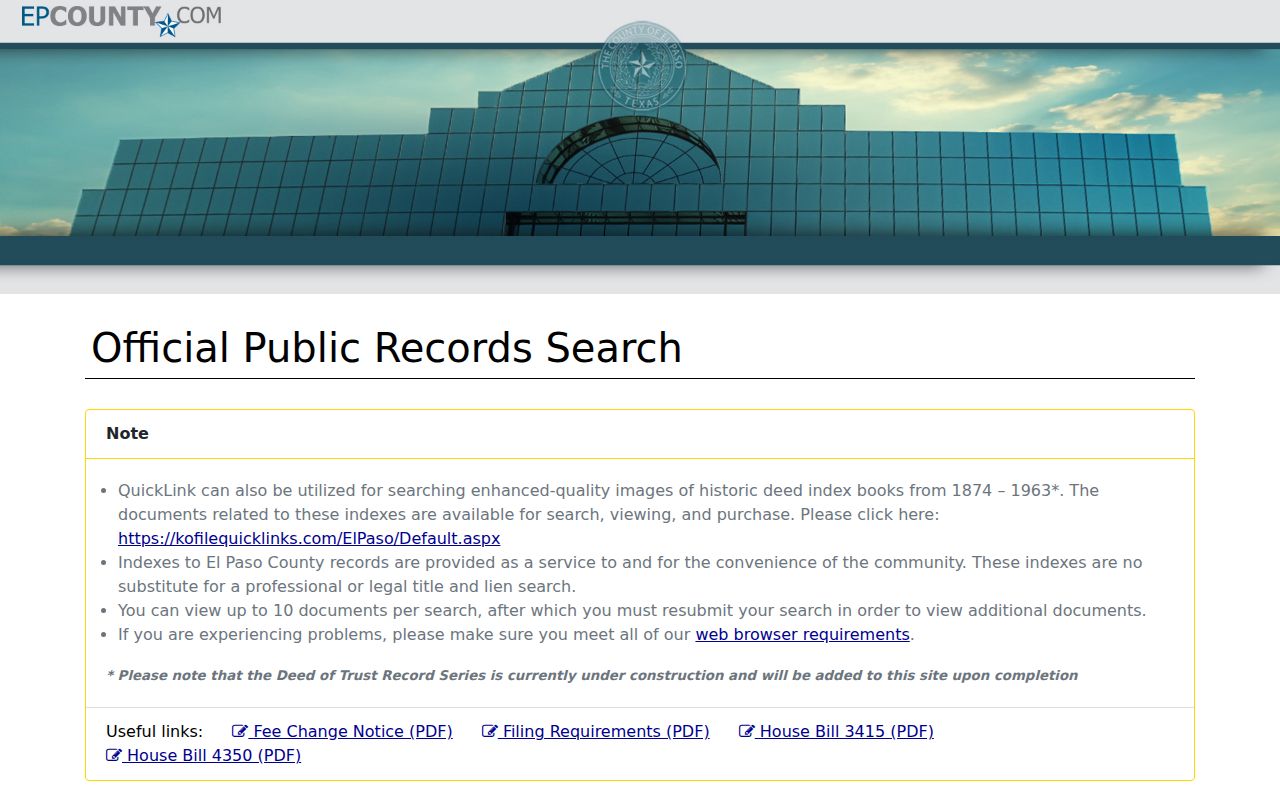
If an El Paso record is absent, use the Clerk counter, copy process, Kofile path, library microfilm, historical-repository staff, or a specific request under the Texas Public Information Act. The El Paso County Clerk asks for a written, specific request and notes a response within 10 business days; production estimates, deposits, and redactions can affect timing. Name the custodian, address, type, date range, and format.