
El Paso Neighbors by Block
Public sources describe different parts of the block around an El Paso address. The City GIS web map gives parcel shapes and address search. EPCAD adds the assessment fields for a parcel. A County deed index can document recorded transfer parties, and a lawful voter-file request can contain a dated registration address under strict state rules. None of those records makes a complete list of current residents. Parcel ownership, occupancy, community membership, and voter registration are separate facts.
| Source | What It Shows About a Block | Access |
|---|---|---|
| City GIS web map | Address search, parcel polygons, neighboring shapes, measurement, and map context | Public viewer; parcel layers appear after sufficient zoom |
| EPParcels and Deeds services | Legal description, MAP_ID, parcel identifiers, situs components, ZIP, year built, and jurisdiction fields | Public query service; save the layer and query date |
| EPCAD | Assessed owner, situs and mailing address, legal description, exemptions, and values | Public parcel search; no comprehensive occupant roster |
| County voter file | Released registered or mailing addresses, districts, registration dates, and voter history in a dated delivery | Written lawful request; protected records and use restrictions apply |
| Neighborhood association resources | Recognized association geography, public community contacts, and meeting-document guidance | City map and public organization materials; not membership lists |
For El Paso neighbors, use the map to establish spatial adjacency first. Then return each parcel to the assessment card for the correct tax year. An owner name may be a person, company, trust, or successor. A mailing address may be an office or agent. A homestead exemption can support a dated owner-occupancy inference, but it does not name renters, guests, household members, or everyone who has lived there.
Mapping El Paso Neighbor Parcels
The City GIS viewer can geocode an address with Find address or place. Zoom until parcel information renders, then identify the target parcel and pan to the touching or nearby polygons. The public services support attribute, spatial, distance, pagination, and statistics queries. A buffer can help identify nearby features where the service accepts it, but distance is a map relationship, not proof of a social relationship or shared household.
The EPParcels layer includes legal description, MAP_ID, and file-as information. The Deeds service adds fields such as PROP_ID, OWNER_ID, LAND_ACRES, YR_BLT, SITUS_ZIP, subdivision, and jurisdiction values. These fields are useful for comparing a map feature to an assessment record. They are not a certified title opinion, and field updates can occur at different times.
For a recorded transfer trail, use the El Paso County Official Records Search with the parcel’s legal description, party name, document reference, or date range. The County’s historic Kofile index is a separate route for the documented 1874-1963 deed-index window. An online index can lead to a record, but the Clerk counter, copy process, or historic books may still be needed for an image or an older gap.
- Center the target address in City GIS and zoom until its parcel boundary is visible.
- Identify the target parcel, note its map location and parcel or object identifier, then inspect adjoining polygons.
- Record the layer URL, access date, and whether each relationship is adjacent, nearby, or only within an association boundary.
- Use the address, Prop ID, or GeoID to check each parcel in EPCAD. Keep the situs address, mailing address, legal description, and tax year in separate columns.
For a full named-street chain, switch to the El Paso street directory. The block method stops at the nearby parcels around one address rather than expanding into a whole-street roster.
Note: A parcel boundary can change through subdivision, consolidation, or map updates, so the map date belongs with every neighbor result.
El Paso Address Layers Matter
Address records use several labels that should not be collapsed. A street address is the location used for delivery or navigation. A legal description identifies subdivision, block, lot, unit, or tract information. The parcel ID, GeoID, MAP_ID, mailing address, and ZIP are separate keys. A legal description may remain stable while a mailing address changes. A street number can change while the same parcel continues.
EPCAD says it does not create or verify situs addresses. City Planning and Inspections and County Public Works are the named address-creation authorities. For a disputed old number or street-name change, request an existing address-history or permit-related record from the relevant authority. No official complete El Paso renumbering table was located in the research, so an old address should not be converted to a current one without dated support.
- Parcel
- A mapped property unit with boundaries and an identifier. It is not a list of all people at the location.
- Situs address
- The physical location label used for the property record, distinct from the address where an owner receives mail.
- Association boundary
- A recognized community-group area shown by the City, not a deed boundary, appraisal neighborhood, precinct, or membership record.
El Paso Neighborhood Associations
The City’s association layer can put a parcel within a recognized community area. It should be read as a community-network overlay, not as a legal subdivision or a roster of El Paso neighbors. The City provides an interactive map, registration and annual-report guidance, and examples of bylaws, agendas, minutes, sign-in material, and email-release practices. Those documents may describe an association’s work, but private member or sign-in details should not be treated as a public list.
| Network or record | Useful public purpose |
|---|---|
| City Neighborhood Associations page | Find the interactive map and current association-registration, annual-report, and meeting-document guidance. |
| El Paso Neighborhood Coalition | A City-linked umbrella network for community contact and association discovery, not an all-resident database. |
| Public association materials | Read bylaws, agendas, minutes, and annual reports for date-specific community context, subject to privacy and redaction. |
| City neighborhood contacts | Use published municipal and community contacts for coordination, not as evidence that a person lives in an association. |
The City Neighborhood Associations and Coalition page is the official source for the public map and guidance pictured here.

Use a recognized association name as a discovery term for public meetings or records. The research did not locate a complete public roster of active association members or historical association boundaries.
El Paso Neighbor Voter Records
The public VoteTexas screen is person-oriented, not a browseable block list. It offers VUID, Texas driver-license or ID, and first-and-last-name methods. A county voter-file request can provide a dated delivery that may include released registration and mailing addresses, districts, registration dates, and voter history. It also carries an affidavit, fees, confidentiality rules, and a limited lawful-use purpose.
A voter address is a registration or mailing fact at a point in time. It does not establish ownership or every member of a household. Texas rules protect Social Security and driver-license values, and qualifying people can protect their residence addresses. The Texas Address Confidentiality Program also offers a substitute address and mail forwarding for qualifying safety situations. Omit protected voter results rather than trying to fill the gap from another source.
Comparing a dated voter source with EPCAD and a recorded instrument may help distinguish records, but it should never be used to publish a block-level voter list. Store the election year and source date with any lawful research note.
Historic El Paso Block Context
A historical street section, newspaper, school annual, photograph, map, or oral-history collection can put a name or business near a block in a particular year. These are time-stamped sources. The El Paso County Historical Society reports city-directory holdings from 1886 through 2011, and El Paso directories can include alphabetical and street sections. A directory listing is a publisher’s association of a name or business with an address during its compilation period, not a current address or title record.
Border Heritage and the Historical Society also hold local newspapers, maps, yearbooks, and vertical files. Search with original Spanish and English forms of a street or name, and preserve the printed place label. El Paso’s borderlands setting means an item may refer to Juárez, Fort Bliss, Ysleta, Socorro, or another county community. Do not merge those places into the City merely because they appear in the same historical source.
Sanborn and Historical Society maps can explain an older building footprint, street number, rail line, school, or neighborhood setting. They are map context, not proof of ownership or occupancy. Historical block evidence should remain separate from present-day El Paso neighbors.
Note: Record the directory year, map date, collection, page or sheet, and the source’s own locality label with every historical block result.
El Paso Block Service Context
City service and permit records can explain activity at an address without identifying residents. The City Planning and Inspections Citizen Access route can expose permitted-work context, while the City says its public field coverage and historical range vary. A permit can distinguish an application, issue, inspection, and final or closed status. An applicant, contractor, owner, and occupant can be different people or entities.
EP311 accepts a category, location or map pin, and request details. It is useful for reporting a local concern, not for building a history of a block or treating an allegation as fact. The public research did not confirm a historical EP311 case index or retention range. Ask the Code Enforcement custodian for an existing case file by address, request number, date range, and disposition when a public record is actually needed.
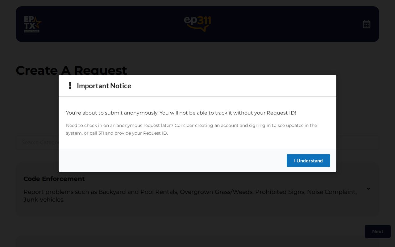
The EP311 anonymous request form shows the category, location, and detail workflow used for City service requests.
A service request is neither a finding of a violation nor evidence that an owner, neighbor, or occupant made the report.
Privacy Limits for El Paso Neighbors
Official rolls and commercial neighbor-lookup tools do not establish the same facts. Official parcel and court sources identify the record and its custodian, date, and access limits. Compiled commercial tools may blend public records, purchased data, marketing data, and user-supplied information. Their refresh timing, matching, completeness, and opt-out process vary. A stale or mismatched entry does not become true because it appears in a compiled result.
| Official source | Compiled neighbor tool category |
|---|---|
| Shows a defined record, source date, and custodian route, such as a parcel card or map feature. | May combine multiple data types with uneven dates, sourcing, and identity matching. |
| Supports limited, source-specific facts such as assessed ownership or map adjacency. | Cannot lawfully reveal protected voter, DMV, utility, delivery, or private membership information. |
| Offers a correction route through the original government custodian when the public record is wrong. | Requires its own documented correction or opt-out procedure for its compiled information. |
Renters, household members, guests, utility customers, delivery recipients, protected voters, and private association members are not a general public neighbors directory. City limits, ZIP codes, parcels, appraisal neighborhoods, precincts, and association boundaries also describe different geographies. Keep the stated relationship narrow: adjacent parcel, nearby feature, association area, or historical block reference.
Lawful use. El Paso neighbor research is for personal, lawful community context and record verification. Do not use parcel, address, voter, or association information to watch, stalk, harass, intimidate, or harm anyone.